
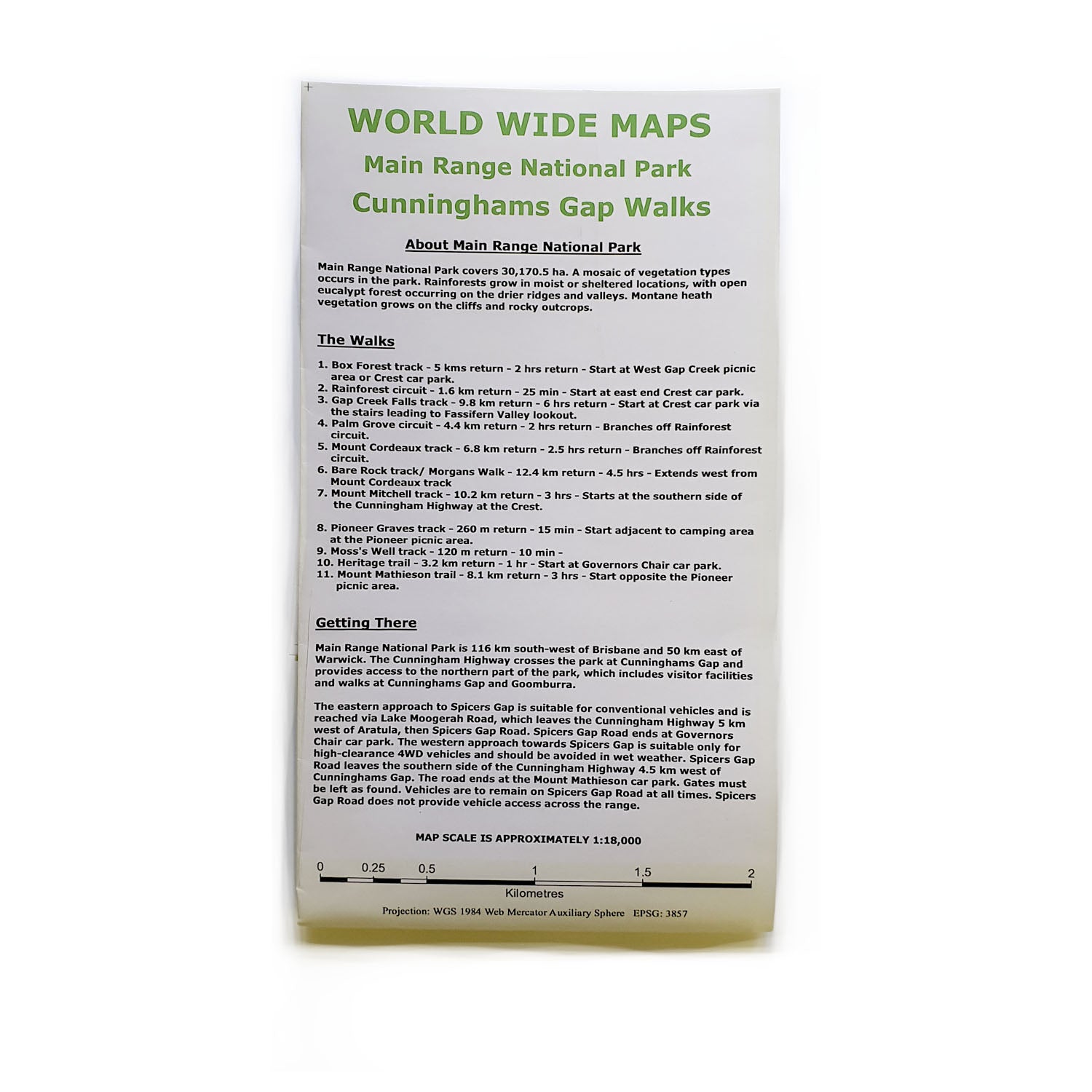
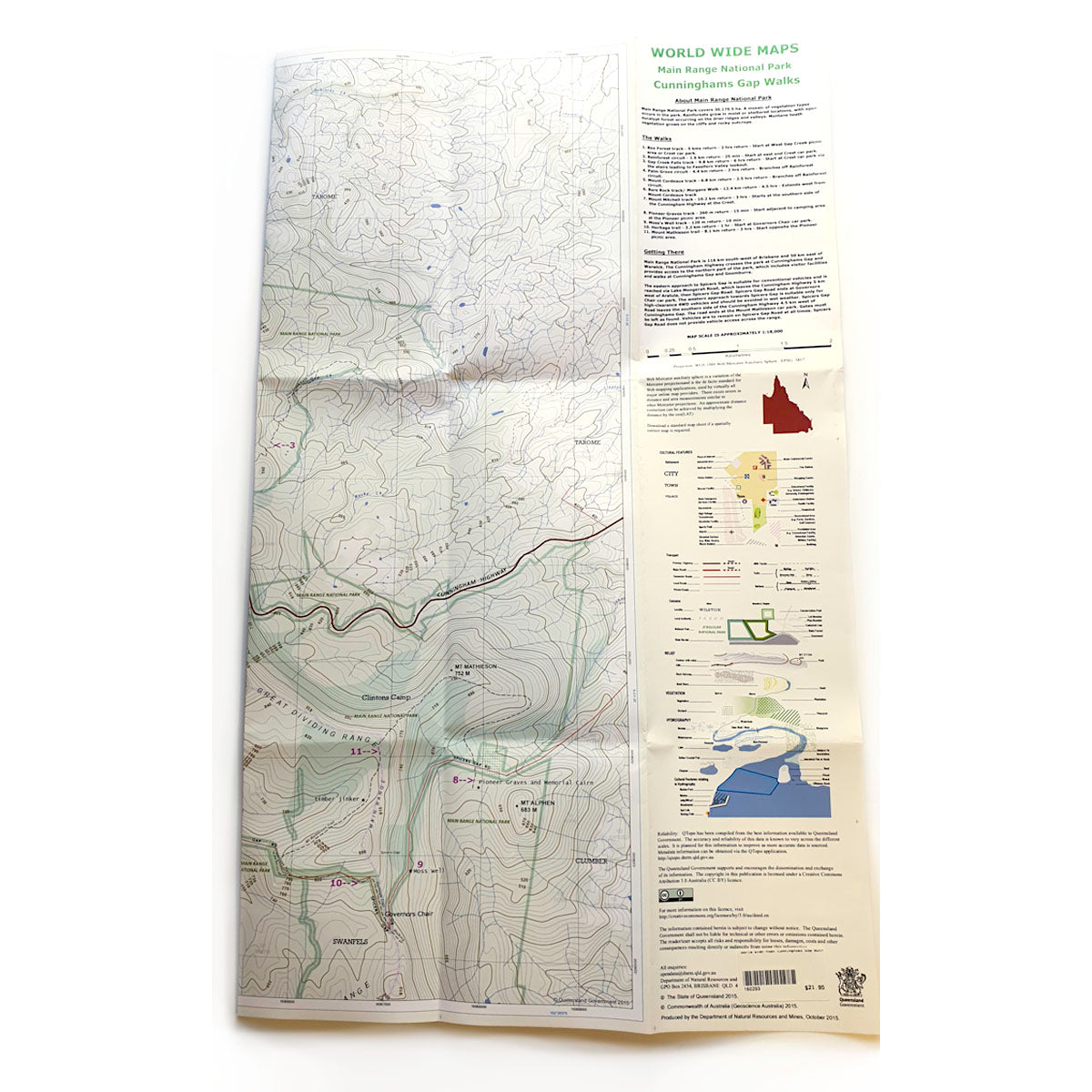
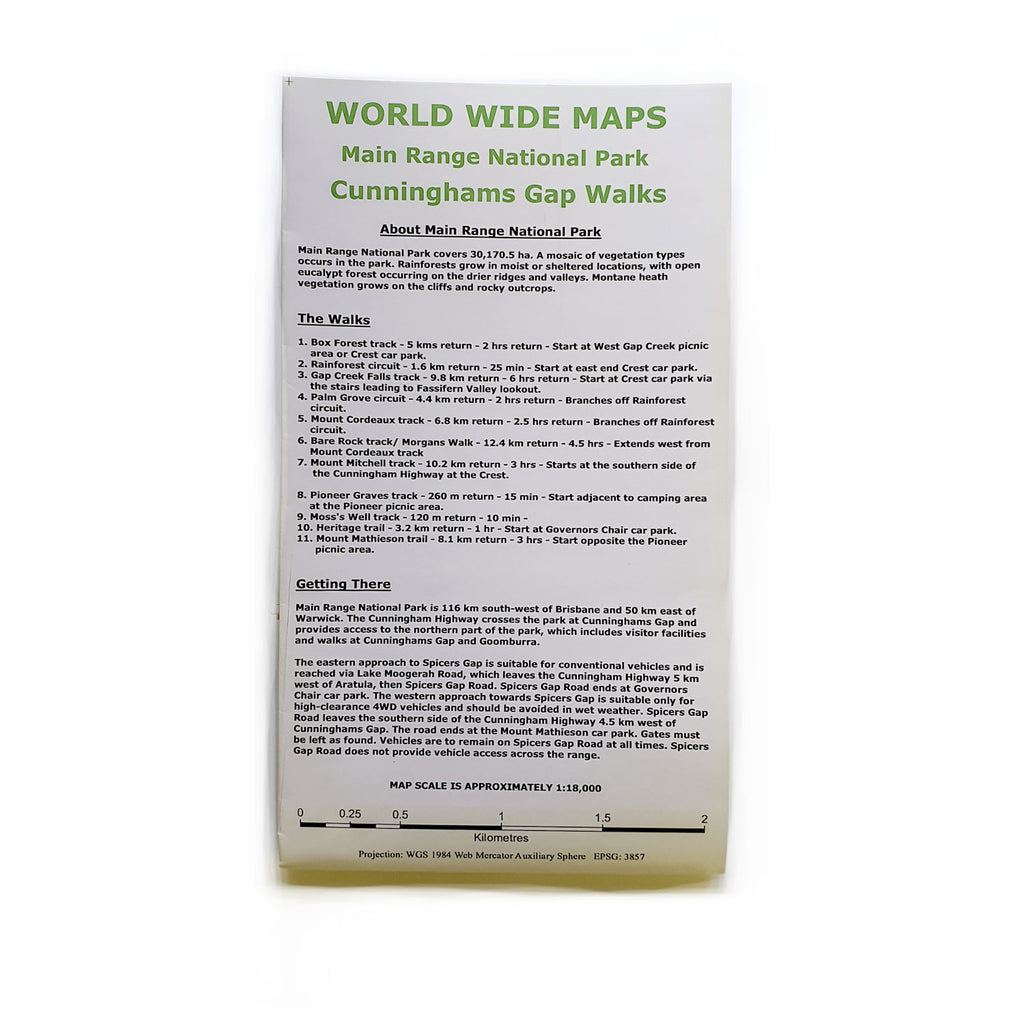

Description
1:18,000 scale topographic map of Cunninghams Gap and Main Range bush walking tracks
Box Forest track
Rainforest circuit
Gap Creek Falls track
Palm Grove circuit
Mount Cordeaux track
Bare Rock track/ Morgans Walk
Mount Mitchell track
Pioneer Graves track
Moss’s Well track
Heritage trail
Mount Mathieson trail
The map comes as compact shirt pocket sized (A3) double sided and folded topographic maps of the Cunninghams Gap – Main Range National Park area. The maps display the best available contours, tracks and the latest topographic information.
The reverse side is a general location topo/road map and the map includes general instructions on how to get to the area.
The map data is sourced from the latest Queensland Government topographic datasets through QTopo and the Government’s Open Data Strategy.
Contact us within 30 days of receiving your goods to request a refund or exchange if products are eligible (see: Return Policy).
All packaging or products must be in their original, re-sellable condition.
Outlet sales are final and can only be returned for exchange. Items found faulty or under warranty will be replaced or refunded.
Some special condition products are labelled as Clearance OR No Refund & Exchange Products. Sale of these items are final and are not eligible for neither refunds nor exchanges.
For safety reasons, K2 cannot accept returns on climbing equipment, socks, underwear and some other products unless faulty.
Please check out our refund policy if you need more information.