
In March 2021, amidst COVID-19 uncertainty, myself and a group of friends took full advantage of cheap flights to Hobart and planned a last minute road-trip around Tasmania. With luck on our side and borders remaining open, it wasn’t long before we were making plans to see as much as possible during the quick break. But with varying levels of hiking experience between us, selecting which day hikes to undertake was tricky. We found the following three trails struck the perfect balance between being achievable for beginners, yet still posing enough of a challenge for others, while also showcasing some of Tasmania’s iconic and diverse outdoor locations.
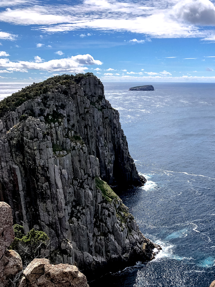
Cape Hauy
Distance: 9.4km return (est. 3-4 hours)
Starting Point: Fort Rescue Bay Camp ground, Tasman National Park
It’s only a 1 hour 40 minute drive from Hobart to the Tasman Peninsula, so Cape Hauy was one of the first walks undertaken by the group. The Cape Huay out-and-back trail is part of the multi-day Three Capes Track, which reaches out to Cape Roaul, Cape Pillar, and Cape Hauy. All three Capes can be completed as standalone walks, and picking between the three (due to limited time) was difficult. While Cape Raoul was probably not as busy, we felt the iconic Totem Pole and Candlestick of Cape Huay were not to be missed.
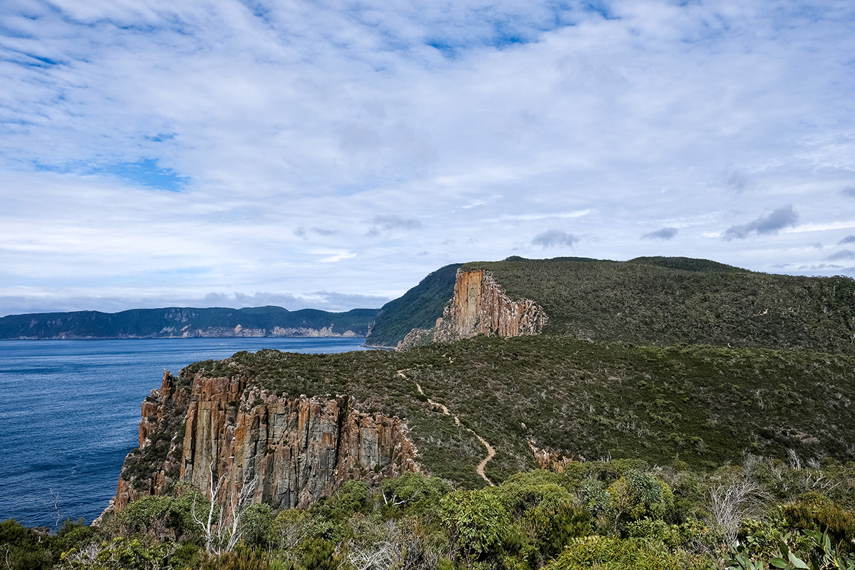
The track itself is well marked, with a waterside gravel trail to start things off, before commencing a relatively challenging uphill stair climb. Anybody with a reasonable level of fitness would find this part of the walk achievable. Once reaching the top of the stairs, there was a short descent, before the trail reverted back to a gradual uphill out along the cape, with wide-open views of the jagged Tasman Peninsula. The lookout platform marked the end of the out-bound journey. Here, there are stunning views of the dolerite columns that stretch down to the roiling, dark-blue waters, with Fortrescue Bay to the North and the Munro Bight and Cape Pillar to the south. Then, it was all about continuing back the way we came, with all the uphill stairs now a gentle downhill stroll.
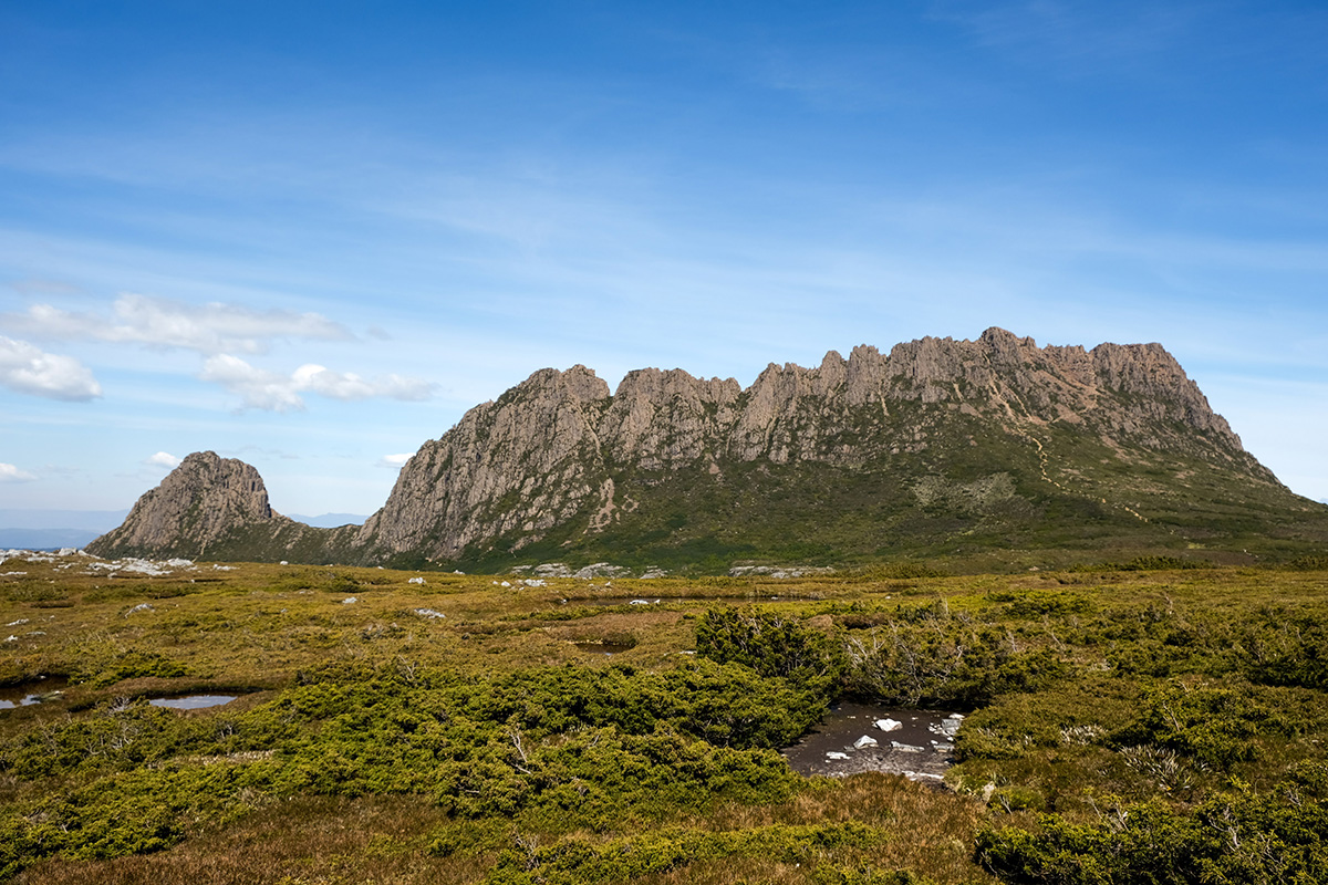
Cradle Mountain Summit
Distance: 12.8km (est. 7-8 hours)
Starting Point: Ronny Creek or Dove Lake Carpark, Cradle Mountain
Cradle Mountain National Park was the next stop on our journey, after the Tasman Peninsula and Bruny Island. It actually required the longest drive on our road trip — a mere 5 hours from Port Arthur.
I was at first apprehensive about pushing for the Cradle Mountain Summit walk, knowing that the track required a bit of rock scrambling and some longer uphill sections. Signposting this to the group, we decided that if anyone felt uncomfortable, we could make the return journey at any time.
We commenced the walk around 7:00am, but the shuttle bus from the visitor car park to the Dove Lake Carpark didn’t run until 8:00am (the road from Ronny Creek to Dove Lake Carpark was not accessible by private vehicles). This meant walking an extra 2km on the road from Ronny Creek to Dove Lake Carpark.
Cradle Mountain was quite cold, and an early morning chill meant layering up, including a hard shell jacket , a long sleeve shirt, and a thermal layer, which were slowly shed over the day.


Once leaving Dove Lake Carpark, we went left around the Dove Lake Circuit, before breaking off to Hansons Peak and continuing on past the Twisted Lakes. We then made our way to the Face Track, where the path narrowed and required scrambling through some tight squeezes. We had an early lunch at Kitchen Hut, peering up towards the summit, with the sawtooth peaks jutting out from the grassy fields.
While starting off as a rocky uphill path, the trail up towards the summit quickly turned into an arduous scramble over larger boulders. With not everyone feeling completely comfortable at this point, we moved slowly in this part of the walk (the scrambling also resulted in a bit of bottleneck, resulting in some light traffic.)
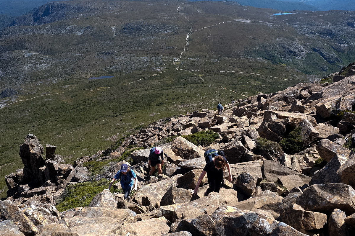
There were quite a few false summits, requiring careful navigation across dips and rises of the boulder fields. We reached the peak at midday, taking some time to enjoy the sweeping views that stretched out over the national park.
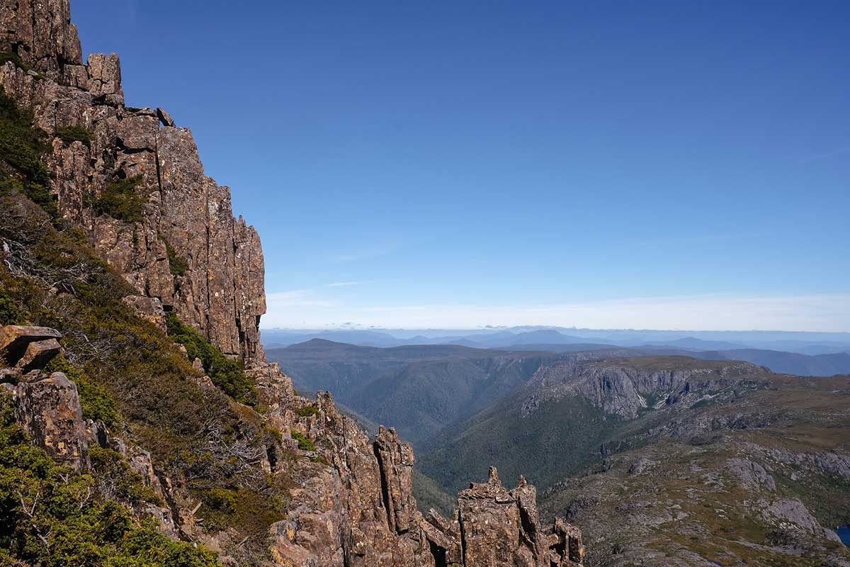
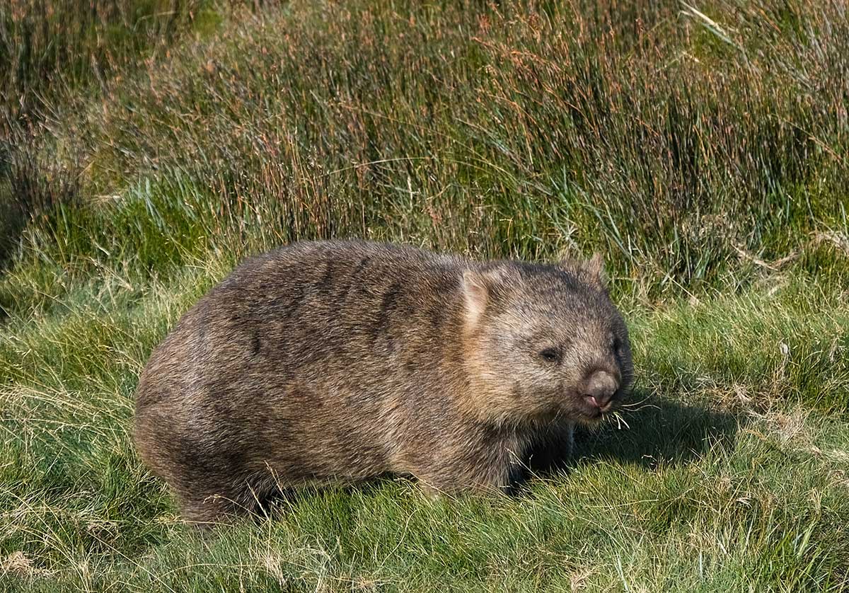
A slow and steady descent was followed by continuing along towards Marion Lookout, then onwards past the Wombat Pools. Instead of making our way back through Dove Lake Carpark, we continued along Lake Lilla Track towards Ronny Creek. A few of us were definitely pushing our limits at this point, dragging our feet as the group chatter went quiet. Spirits were lifted with wombat sightings where the Lake Lilla Track joined back up with the Overland Track, marking a great end to the demanding full-day trek.
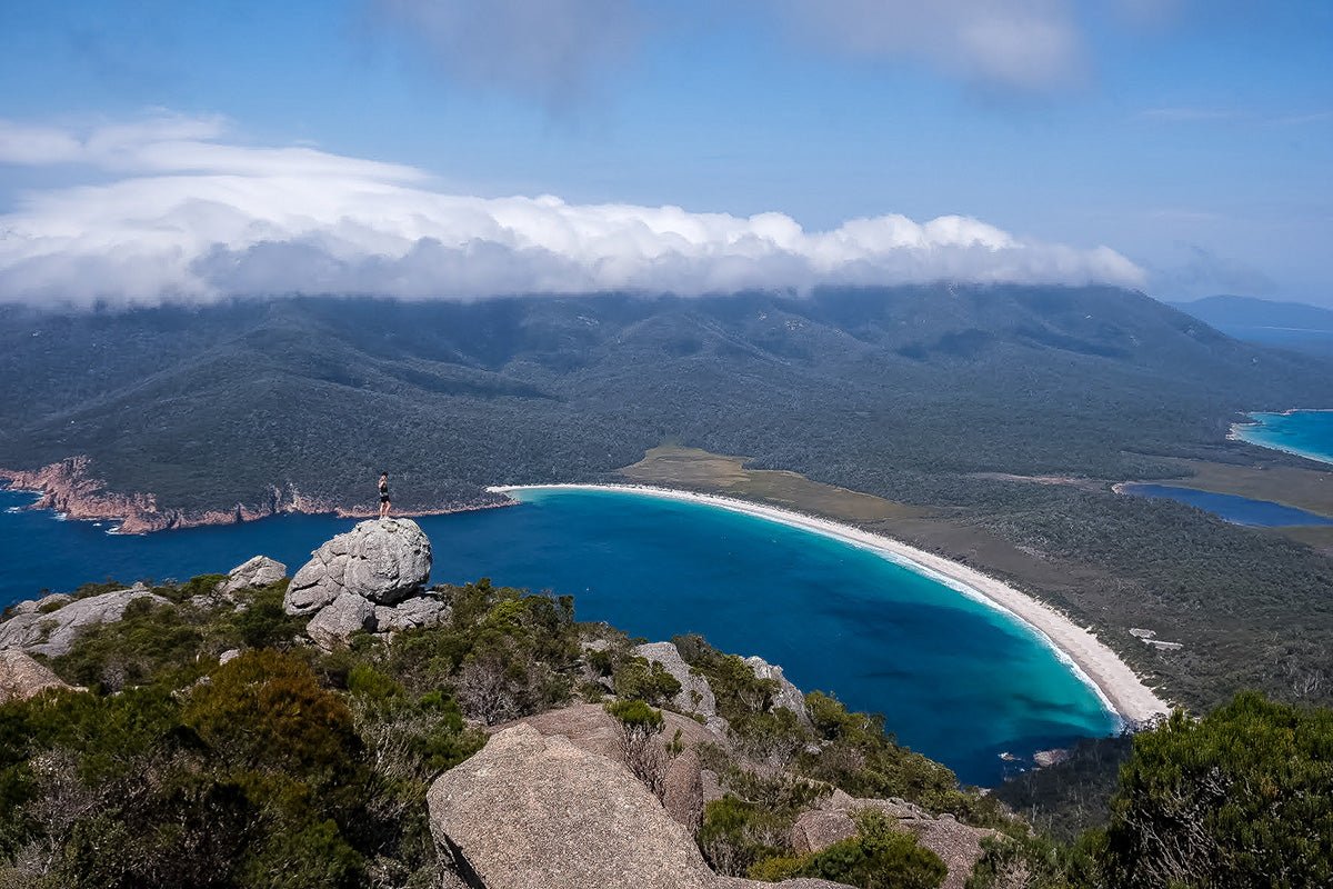
Mount Amos Summit
Distance: 4.3 km return (est. 3 hours)
Starting Point: Wineglass Bay Carpark, Freycinet National Park
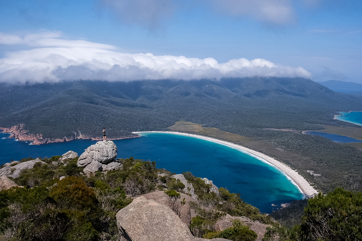
With the group's confidence boosted post-Cradle Mountain, and closing in on the end of the trip, we were after one more outdoor adventure. A 2 hour drive from Launceston brought us to Freycinet National Park, and to Mount Amos — a granite peak (454m) that forms part of a mountain range known as the Hazards.
The walk itself, starting from the busy Wineglass Bay Carpark, is marked by warning signs, highlighting the (sometimes) slippery and steep nature of the trail. While starting out on a flat dirt track and sections of boardwalk, we quickly reached the granite boulders, which required a steady ascent and selective footing (possibly much trickier in wet weather). We enjoyed the views over Coles Bay and the colour variation in the boulders, as the path continued to grow steeper.
While still achievable, the track did present some more difficult sections. I don’t think any of us anticipated just how exposed and steep some of the boulder scrambling was, but this definitely contributed to the sense of adventure and excitement experienced on the hike. The occasional breeze would even leave some of the group's more experienced hikers white-knuckled and pressed against the rock face. We often sought out tree branches and finer foot holes to hoist ourselves up the sloping boulders. While my sturdy, yet cumbersome, hiking boots had been consistently great for grip and ankle support, it was here that I wondered whether a lighter boot/running shoe would have been more useful.
The track flattened out again, with some narrower squeezes through boulders and vegetation just before a false summit. While the sights out towards Coles Bay were impressive, it was only after walking a little further along the rocks that we were granted access to one of our favourite views in all of Tasmania. The view over Freycinet Peninsula consisted of thin white stretches of sand contrasting with the brilliant blues of Wineglass Bay and the rolling green mountain ranges.
The return actually proved more difficult than the ascent, with the steep slopes requiring us to take greater care where we placed our feet. The Mount Amos summit provided a challenging, yet rewarding finale to our road trip, as well as a great confidence and skill boost for some, and a welcome return to the outdoor lifestyle for others.